
Arizona ZIP Codes and Their Reach
Arizona ZIP codes mark postal routes, not a clean set of town borders. The examples below show how a code can point toward Phoenix, a Pinal County post office, the Tucson area, or an Arizona rural route without proving which county office keeps a parcel record. ZIP ranges are grouped for orientation because the research did not locate a browser-friendly USPS file listing every current Arizona delivery code and post office. A number span is not evidence that every number in it is assigned. In Arizona, a post-office label can outlast a municipal map line. Use the exact delivery address in USPS ZIP Code Lookup, then use Arizona parcel and map records to confirm county and city jurisdiction.
| ZIP | Areas Covered | Post Office | Notes |
|---|---|---|---|
| 85001, 85004, 85012, 85032, 85048 | Phoenix and Maricopa County routes in Arizona | Phoenix | Arizona city limits and postal service area differ. |
| 85201, 85210, 85224, 85248, 85281, 85295 | Arizona's East Valley, including Mesa, Chandler, Gilbert, Scottsdale, Tempe, and Fountain Hills | Several East Valley post offices | One Arizona metro area has many city and post-office assignments. |
| 85301, 85345, 85373, 85383, 85396 | Arizona's West Valley and rural Maricopa routes | Glendale, Peoria, Surprise, and other service areas | Check Arizona county GIS for the city line. |
| 85120, 85122, 85132, 85138 | Arizona's Pinal County, including Apache Junction, Casa Grande, Coolidge, Florence, Maricopa, and Eloy | Pinal County post offices | Postal place and Arizona parcel jurisdiction can differ. |
| 85602 | Southeastern Arizona; mapped across Cochise and Pima county contexts | Confirm by exact address | Do not infer parcel county from the ZIP alone. |
| 85701, 85741, 85747 | Tucson-area and Pima County routes in Arizona | Tucson-area post offices | Tucson ZIPs do not define the Arizona city limits. |
| 86301, 86314, 86326, 86336 | Yavapai County, Arizona, including Prescott, Prescott Valley, Cottonwood, and Sedona-area routes | Prescott, Cottonwood, Sedona-area service | Sedona has a county and city context in Arizona. |
| 86403, 86442 | Mohave County in western Arizona, including Kingman, Bullhead City, Lake Havasu City, and river routes | Mohave County service areas | Verify the Arizona address and county separately. |
These rows are regional examples, not a complete Arizona ZIP code directory. Arizona's postal map also includes White Mountains, tribal, border, mining, and river communities whose post-office names may not match a nearby incorporated place. Some Arizona codes serve PO boxes or one institution; others are noncontiguous or cross a city line. Use the official USPS lookup for one Arizona delivery point and the Arizona Geo 911 ZIP layer to compare postal areas on a map.
Arizona ZIP 85602 Crosses Counties
ZIP 85602 is a useful Arizona geography check because a regional planning map documents it across Cochise and Pima county contexts. An Arizona search that starts with the postal code can therefore lead to the wrong recorder or assessor if the parcel's jurisdiction is assumed. The ZIP is a delivery label. The Arizona county parcel map and legal description show where a particular lot sits, and the assigned county determines which recorder holds its deeds and plats.
Keep the postal place, Arizona county, incorporated city, and tribal or unincorporated jurisdiction in separate fields. The same care helps around Sedona, metropolitan Maricopa, and Arizona's Pinal County edges, where a familiar mailing city can cross a city line or describe an address outside that city's limits. When an older Arizona record uses a former town or post-office name, search that wording as well as the current street form. A parcel number or recorded subdivision name can bridge the change.
Arizona ZIP geography is especially easy to misread at county edges. Use the Arizona state ZIP service to see a boundary, then confirm the target parcel in its Arizona county GIS. A map view suggests where to look; it does not assign a legal custodian by itself.
Arizona Parcel ZIP Fields
The Maricopa County Assessor parcel layer makes a key Arizona distinction visible: each parcel can have both a physical address and a mailing address. Its fields include PHYSICAL_ZIP, MAIL_ZIP, physical street number, direction, name, type, suite, city, and the separate MAIL_ADDR, MAIL_CITY, MAIL_STATE, and MAIL_CNTRY values. APN is the Arizona parcel key that lets a researcher return to the same property across map, assessor, and recorder views.
| Field | What It Describes | Use in an Arizona ZIP Search |
|---|---|---|
| PHYSICAL_ZIP | ZIP tied to the parcel's physical or property address in Arizona | Compare the Arizona parcel location with a postal boundary. |
| MAIL_ZIP | ZIP used for Arizona parcel-owner correspondence | Keep separate from the Arizona place where the parcel sits. |
| PHYSICAL_ADDRESS | Street number, direction, name, type, suite, city, and ZIP fields | Normalize the address before mapping or looking up a delivery point. |
| MAIL_ADDRESS | Mailing lines, city, state, ZIP, and country | Read as a notice destination, not a claim of residence. |
| APN | Assessor parcel number, with dashed and undashed forms in Maricopa help | Carry the parcel ID into GIS and recorder searches. |
Other Arizona counties have separate assessor portals, and their filter controls differ. Maricopa's assessor search help accepts parcel number, owner name, or street address; a failed address search may improve if the street type, city, state, or ZIP is left out. The relevant Arizona county portal should decide which fields can be queried directly.
Find Arizona Residents by ZIP Code
A ZIP code narrows a place for research, but it does not produce a statewide roster of residents. Arizona county parcel services may expose a physical ZIP filter; Maricopa's map layer includes PHYSICAL_ZIP and MAIL_ZIP. Voter registration also stores a ZIP, though the individual Arizona voter portal is for a person checking their own status. An Arizona county recorder handles authorized voter-file inspection and requests under the rules that apply to that record.
- Enter the full street address in USPS ZIP Code Lookup and confirm the delivery ZIP.
- Open the Arizona county assessor or GIS service and note whether the field is physical ZIP, mailing ZIP, or both.
- Save the APN and Arizona county with the result, then compare the parcel against the Arizona Geo ZIP boundary layer.
- If an Arizona voter record is relevant, use the portal only for a self-check or contact the county recorder about a lawful request.
Recorder indexes tend to use names, addresses, legal descriptions, dates, and document types rather than a ZIP as the main historic key. Once a postal area has been narrowed to a street, the Arizona street directory follows the address into parcel and deed records. An Arizona Public Records Law request to the right custodian can be the next step when an online roll lacks a field or date range; identify the record series, address or APN, dates, and preferred format.
USPS Exact-Address Check
For an Arizona address, USPS ZIP Code Lookup checks a delivery location rather than a city boundary. Use its official address lookup with the street information before treating a ZIP from a directory, map, or older Arizona deed as current. The postal result helps settle routing; an Arizona county assessor still supplies parcel and mailing fields for the land record.
| Street address | Enter the delivery location to check a specific address. |
|---|---|
| City and state | Keep the Arizona place name with the address; a postal city can differ from the municipality. |
| ZIP result | Compare the USPS answer with Arizona PHYSICAL_ZIP and MAIL_ZIP separately. |
The USPS Arizona address lookup screen shows the exact-address and city/state check. A confirmed delivery ZIP gives a sound starting point for an Arizona map comparison, but it does not establish who occupies the address.
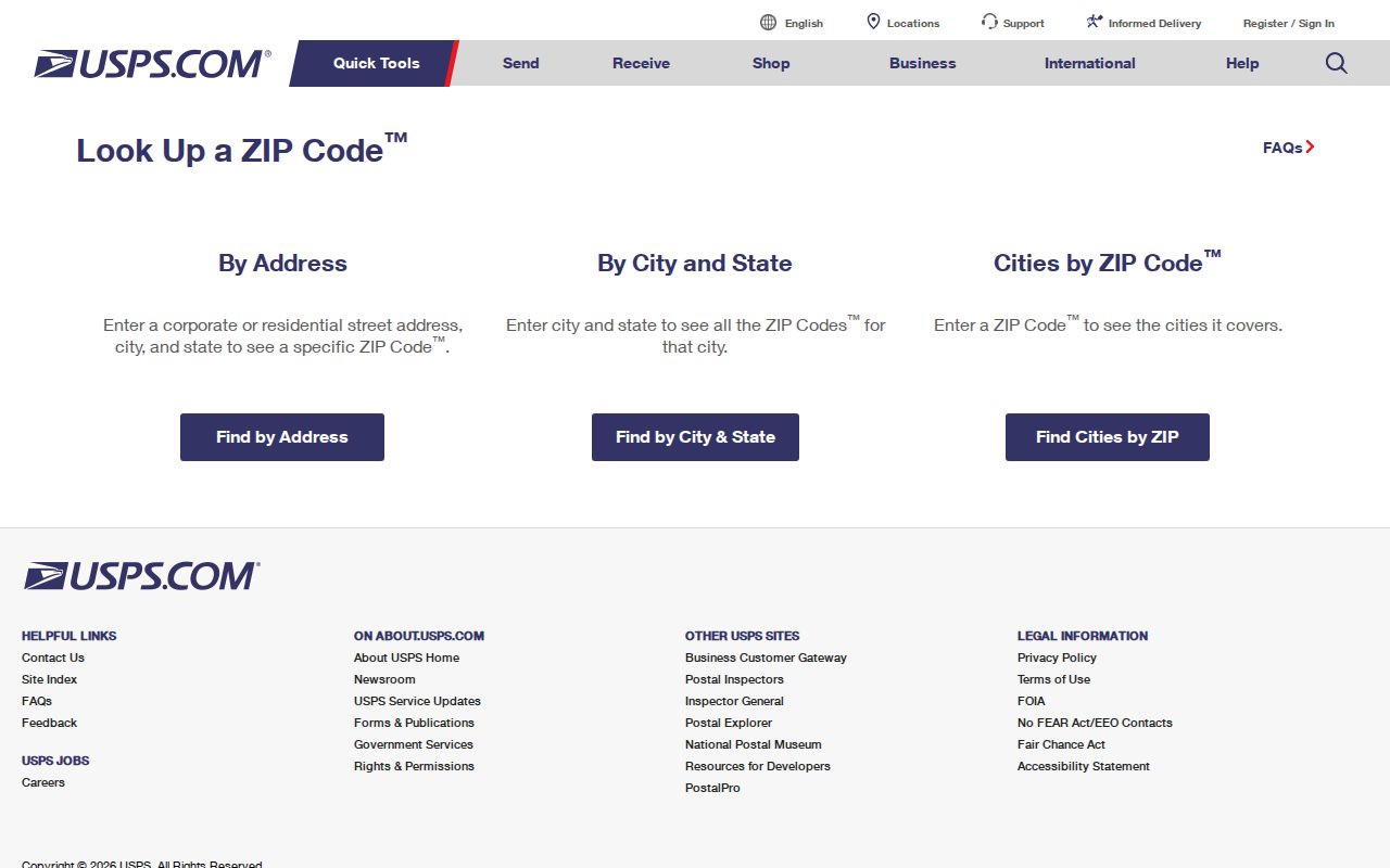
After the postal check, compare the Arizona address with the relevant Arizona county GIS and keep the result date in your notes. Arizona parcel data and ZIP boundaries answer different questions about the same place.
Arizona ZIP Code Directory: Split Streets
In Arizona, the two sides of a street can sometimes have different ZIP codes. A street name or a boundary polygon cannot settle which postal code serves a particular home. Check the complete street address through USPS, including number, direction, name, and type, then retain the result for that delivery point.
A useful Arizona ZIP code directory keeps each returned address and ZIP together instead of assigning one code to an entire street. Postal routing describes delivery geography; use county and municipal maps separately to determine jurisdiction.
Arizona ZIP Polygons vs Delivery Points
Postal routes in Arizona begin with delivery points, while Census ZIP Code Tabulation Areas, or ZCTAs, are generalized polygons made for mapping and statistics. The Census ZCTA guidance explains why a ZCTA is not a full USPS list. Some valid Arizona ZIPs have no ZCTA, and a PO-box-only or unique institutional code may not look like a broad polygon. An Arizona boundary layer can also appear noncontiguous or stop at a data edge. Treat map shapes as a way to see general geography, not as proof that every address inside the shape uses that ZIP.
Arizona's Geo 911 service offers a statewide ZIP boundary layer for queries. Pair that polygon with a USPS exact-address result when an Arizona address matters. Then check the Arizona county, city, and parcel separately. The Census layer can help compare population or draw a regional map, while USPS validates delivery, and assessor data joins property fields. None of those sources alone answers every question behind an Arizona ZIP code directory.
Arizona's rural routes and tribal places make the distinction practical. An Arizona post-office name may carry farther than a municipal boundary, and an institutional code may not describe an Arizona neighborhood at all. Keep the original Arizona postal text next to the normalized street and APN so another researcher can repeat the search.
Arizona ZIP Codes Across City Lines
An Arizona postal label can use the nearest familiar city name even when the parcel lies in another municipality or an unincorporated area. Phoenix and Arizona's East Valley ZIP groups span distinct cities; Pinal County post-office names can diverge from Arizona city and county boundaries; Tucson codes do not draw Tucson's legal line. Sedona's county context also cannot be settled by its ZIP alone. Arizona searches should resolve the Arizona county and local jurisdiction before routing a deed, permit, or public-record request.
Boundary check. Keep the USPS result, Arizona county parcel, and local city or county boundary map together. A postal city name is not an Arizona jurisdiction ruling.
- ZIP+4
- The four extra digits refine delivery routing beyond the five-digit ZIP.
- PO-box ZIP
- A code assigned to post-office boxes rather than ordinary street delivery.
- Unique ZIP
- A code assigned to one institution or organization, rather than a general neighborhood.
- Carrier route
- A postal delivery path within a larger ZIP service area.
If an Arizona county portal does not show the detail needed, contact the Arizona office that keeps the record. Arizona Public Records Law allows requests for inspection or copies, with copy and postage costs where applicable; describe the exact Arizona record, location, APN, and date range instead of asking staff to assemble a new directory.